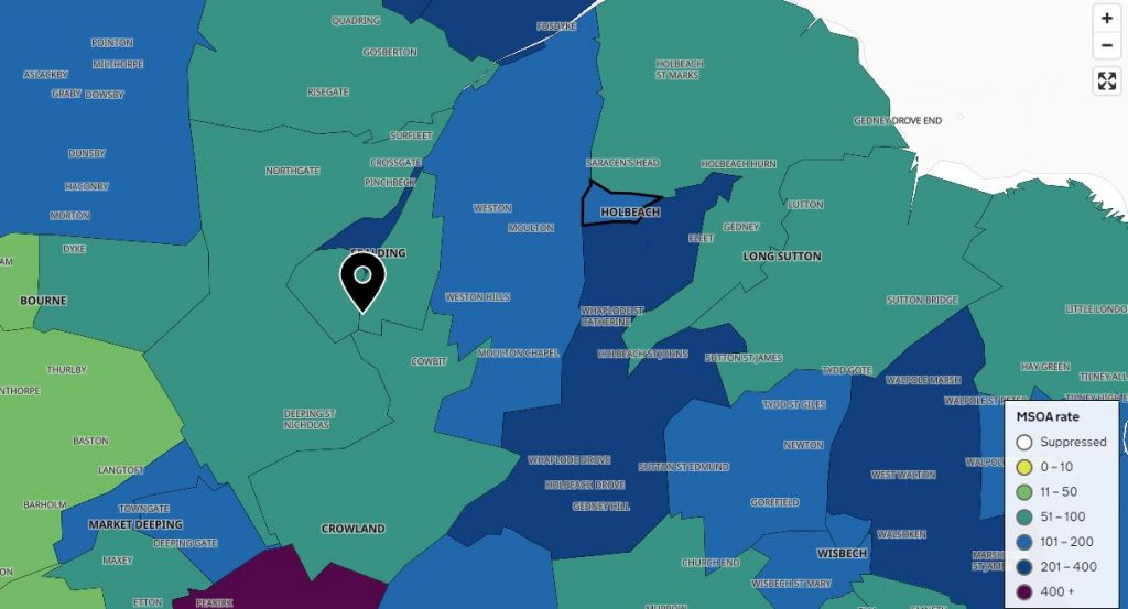
A map of COVID-19 cases over a seven-day period has been released by the government which shows most areas of South Holland have falling rates of the virus, but not all.
In the most up to date figures which cover the week up to December 5, Spalding North has the highest rate of the virus in the district with a ‘rolling rate’ of 306.8 cases per 100,000 population. That equates to 40 total cases, an increase of 38 per cent on the previous seven days.
Other areas in the district which have above UK average case rates include Fleet Hargate and Holbeach St Johns which has 14 cases for a rolling rate of 206.1 (an increase of 75 per cent) and Holbeach itself with 12 cases, up six from the previous seven days (158.7 cases per 100,000).
Spalding South West has had a slight increase of two cases but remains below the UK average, but other areas in South Holland have seen a decrease in cases including around 50 per cent drops in Spalding East, Long Sutton East and Sutton Bridge, Donington, Quadring and Gosberton and Pinchbeck and Deeping St Nicholas.
Crowland and Cowbit has just four cases and saw a more than 70 per cent decrease with a rolling rate of 59 per 100,000. That’s in contrast with the neighbouring area of Newborough and Peakirk in Cambridgeshire (and in tier two of restrictions) which has had a 191 per cent increase in cases in the last seven days and a rolling rate of 434.
You can view the interactive map here.
Lincolnshire and South Holland remain in the higher tier three of government restrictions, an update to which is due from central government next week.
On Wednesday, Lord Gary Porter, the leader of South Holland District Council, tweeted: “(It’s) Looking like the only way @SHollandDC will escape the baseless inclusion in tier 3 ( apart from the 5 day parole everyone will get) is being wrapped up in a new national lockdown in the new year.”
