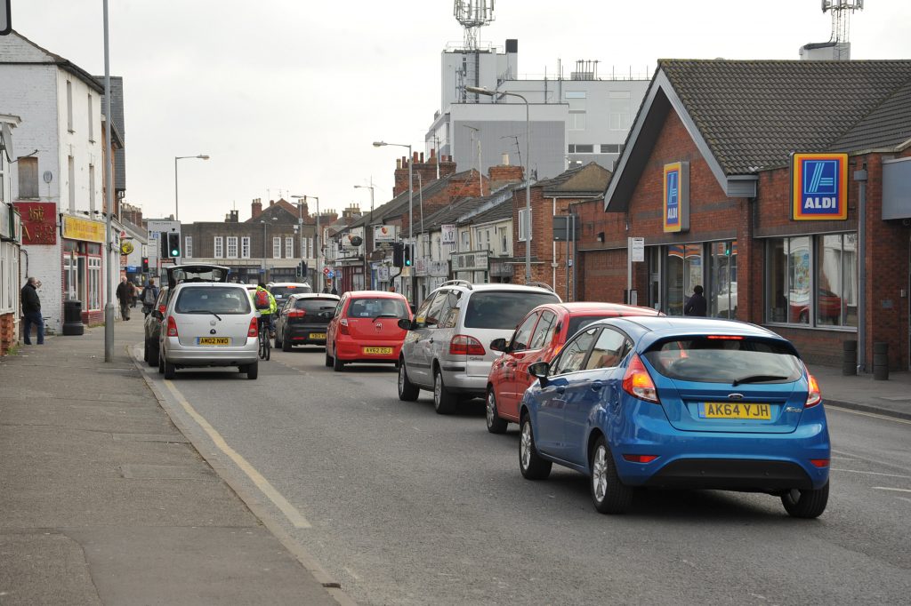
A two-week study measuring traffic flows in and around Spalding and Holbeach started this week.
Lincolnshire County Council has announced that more than 90 locations would be monitored to record traffic for 14 days which started on Thursday (May 8).
“Once all the information has been collected, a team of analysts will check, process and review all of the data, ready for it to be incorporated into a new traffic model for Spalding and Holbeach,” said a statement from the council.
The details will be used to feed into an updated version of the Spalding Transport Strategy for the coming years.
“By collecting up-to-date traffic flow and journey time statistics using a range of data gathering tools, we can use the intelligence we gather to help reduce delays and congestion in the town centre,” said Karen Cassar, assistant director for highways.
“Once completed, the new traffic model will also be used in an updated version of the Spalding Transport Strategy,” she added.
The current strategy was completed in 2014 and covered a time frame from 2014 to 2036. It forecast a population increase of 31 per cent in South Holland in that timescale and said the strategy aimed to ‘address existing transport issues and supports the emerging proposals for significant housing growth.’
The problem of congestion caused by the level crossings in Spalding town centre has not changed since the document was produced.
It also spoke of the ‘integral part’ the new Spalding Western Relief Road would be to the future.
“The scheme has been identified as one of four major schemes within Lincolnshire in the short to medium term.
The scheme is important locally because it will play a major role in opening up development sites . . .it also provides an alternative route to the congested A151 route which passes through the centre of Spalding.”
In the 11 years since the document first appeared, the relief road consists of one stretch of road which is currently gated and leads nowhere.
No funding has been secured to see the relief road completed at any time in the near future. But peak-hour traffic has increased in the intervening period.
“At an early stage of the project, the SWRR was identified as the most important infrastructure project for the local area,” the strategy said.
The junction of Winsover Road and St Thomas’ Road in the town centre was highlighted as a problem area.
The strategy’s desired outcomes included a reduction of traffic in the town centre, reduction in carbon emissions from transport and an increase in public transport services to Lincoln, Sleaford and Peterborough.