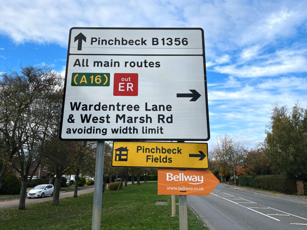
There are many signs along roads in South Holland – but not everyone knows what the red ER signs are for.
Evacuation Route (ER) signs show the route that people should take to safely self-evacuate in extreme events like flooding.
There are 13 routes across Lincolnshire, which are signposted by the signs.
Mark Baxter chairs the Lincolnshire Resilience Forum and explained that the signs are becoming even more important.
He said: “Clearly we’re seeing a trend of weather-related events that are growing and are changing the landscape with regards to the risk that we’re having to deal with.
“These were designed and developed purely on the backdrop of our flood risk.
“They are emergency routes and what I would say is that if there was any other type of event where we needed to have mass evacuation of certain areas, this is just one tool in our armour to be able to support the evacuations of large amounts of people.”
The signs were installed in 2015 following the 2013 floods which devastated more than 800 properties across Lincolnshire.
They cost about £100,000 to be put in and were funded by the Department for Environment, Food and Rural Affairs (DEFRA).
Mr Baxter, who is also chief fire officer for Lincolnshire Fire and Rescue, explained that many of the signs are concentrated around Boston and South Holland because there are “higher risk flood areas”, with Boston being one of the most severely affected areas during the 2013 floods.
He explained that the ‘out ER’ symbol represents the route that people should take to get away from the danger and get to higher ground.